Click Here to view Map Legend
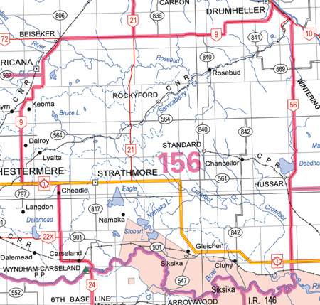
Rosebud River Wildlife Management Unit (156)
Commencing at the junction of highways 1 and 9; thence northerly and easterly along highway 9 to highway 10; thence southeasterly along highway 10 to highway 56; thence southerly along highway 56 to highway 1; thence continuing southerly and easterly along an unnamed gravel road approximately 3 miles to the Ferry landing; thence directly across the Bow River to the right bank of the Bow River; thence upstream along the right bank of the Bow River to highway 24; thence northerly and westerly along highway 24 to highway 1; thence westerly along highway 1 to the point of commencement.